Text description provided by the architects
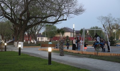
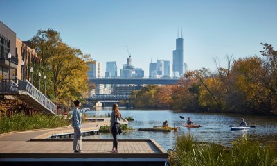
Baoshan Waterfront Phase One is located at the confluence of the Yangtze and Huangpu rivers, on an important stretch of Shanghai's Yangtze waterfront, where the water is wide and the pre-renovation shoreline consisted of concrete flood walls and access roads. The landmark inland is the Wusongkou International Cruise Terminal. Against Shanghai's initiative to open both banks of the Huangpu to the public, Baoshan aims to transform a flood-control waterfront into an urban-transition focus. The challenge is to integrate the flood wall's two platforms into an open waterfront while boosting ecology and public appeal. Under the theme Baoshan's Bow, the design combines river, cruise ship and local culture, proposing three strategies: natural resilience, playful experience and community integration. The three continuous paths run as follows: walking and jogging tracks on the second platform, upgraded from existing grading and paving; cycling along the inland and urban edges; and a more waterside garden trail on the first platform. The flood wall is a first-line Yangtze structure that cannot be destructively altered. Rather than a passive wave-barrier, the team proposes a wave-play barrier, turning a forgotten gray flood structure into the best vantage on the Yangtze. On the second platform, a city bar keeps the wave wall as an engineering relic and folds urban life into its thick parapet like a ship's deck. On the first platform, a wave garden replaces hard paving with naturalistic planting, using undulating layouts and micro-terrain for playful, interactive experience. Service stations along the waterfront support sports, leisure and events. The design prioritizes community connectivity; after completion, the shoreline quickly became the most popular destination for surrounding neighborhoods. Because the first platform floods in season, is exposed to strong wind and cannot have its foundation disturbed, the design uses precast concrete modules as paving with sufficient ballast for extreme storm conditions, while serving as soil stabilization for amphibious planting on the masonry embankment. Drought- and flood-tolerant ground covers that sway in wind were chosen. Nine months after completion, Typhoon In-Fa brought red-level storm surge; most vegetation survived, though some waterside ground cover lodged and required repair, prompting long-term ecological monitoring. The 2.2-kilometer shoreline demonstrates a low-impact, naturalistic update of gray municipal flood infrastructure.




 Editor's Pick
 Latest Design