Text description provided by the architects
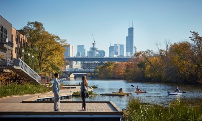
The Puyang River Ecological Corridor in Pujiang County, Zhejiang Province, stands as the flagship project of the province's landmark Five Waters Co-governance initiative, a pioneering water-management campaign that began precisely with the restoration of Pujiang's mother river. The client was the Pujiang County Housing and Urban-Rural Development Bureau. The project transformed a once-abandoned, severely polluted waterway into the most beloved ecological and recreational corridor for local residents. Originating in Pujiang, the Puyang River is a major tributary of the Qiantang River, stretching 150 kilometers through Zhuji and Xiaoshan before its confluence. The intervention covers approximately 17 kilometers within Pujiang County, spanning 196 hectares with widths ranging from 20 to 130 meters, extending upstream from the Tongji Lake reservoir dam to Green Lake and downstream from Pujiang No. 4 Middle School to the Yiwu Stream. Pujiang, once known as the Crystal Capital of China, produced over eighty percent of the nation's crystal products at its peak, with twenty-two thousand workshops and two hundred thousand workers. The boom left a devastating environmental legacy: four hundred sixty-two milk rivers, five hundred seventy-seven garbage rivers, and twenty-five black and odorous rivers, with water quality rated Class V-inferior for eight consecutive years. The design response deployed integrated ecological water purification, sponge-city stormwater management, water-friendly adaptive design, and minimal-intervention landscaping. Seventeen tributaries were intercepted by a system of constructed wetlands totaling 29.4 hectares, while 166 hectares of wetland-park space, eighty-four percent of the corridor, now purify runoff before it enters the main river. Key wetland nodes were positioned at every tributary confluence, including Green Lake Wetland Park, the Huanglongxi and Taoyuanshi purification patches, the Fengcun wastewater treatment plant tail-water wetland, and the Sanjiangkou wetland downstream. The completed retention wetlands store roughly 2.9 million cubic meters of water, increasing flood retention capacity by approximately 1.5 million cubic meters. More than 3,400 meters of formerly hardened riverbanks were ecologically retrofitted: concrete surfaces were broken up and planted with deep-rooted native trees, while demolished rubble was reused as riprap slope protection. Boardwalks were elevated to minimize obstruction of flood flow while supporting amphibian migration. A 25-kilometer cycle route largely follows existing levee roads to preserve the native wingnut forest. The plant palette relies strictly on local species interspersed with fruiting trees such as bayberry, persimmon, cherry, loquat, peach, pear, and mulberry, beneath which ornamental grasses, reeds, canna, and water lilies thrive. Existing hydraulic infrastructure, including seven weirs, eight pump stations, and a historic aqueduct, was preserved and adaptively reused as a 1.3-kilometer heritage experience walkway. Water quality has recovered from persistent Class V-inferior to stable Class III, demonstrating that maximum benefit can be achieved through minimum-cost ecological investment.




 Editor's Pick
 Latest Design